Zhangjiajie Travel Guide: Six Places Worth Visiting (with a Four-Day Itinerary)
Zhangjiajie lies in the northwest of Hunan Province, deep in the Wuling Mountains, and was formerly known as Dayong. It became a prefecture-level city in 1988 under that name and was renamed Zhangjiajie in 1994. The permanent population is about 1.52 million, over two-thirds of it Tujia, the highest share of ethnic minorities of any city in Hunan. Downtown sits at 183 meters above sea level on average, while the scenic areas average about a thousand. The quartz-sandstone pillar forest of Wulingyuan is rarely matched anywhere, and it was put on the UNESCO World Heritage list in 1992. Every entry on this list has had its origins checked against public sources. The core of Zhangjiajie is Wulingyuan; Tianmen Mountain sits right by the city; the glass bridge spans a grand canyon; and Huanglong Cave runs underground.
When to come to Zhangjiajie
Zhangjiajie has a mid-subtropical monsoon climate with four distinct seasons. The city averages 16°C a year with about 1,400 millimeters of rain, and the scenic areas run roughly 800 meters higher, so they are cooler accordingly. April to October is the travel window, with September and October the most stable months — after a rain the clouds often part into a sea of mist. May to August is the concentrated rainy stretch; showers arrive without warning, fog sits heavy on the peaks, and seeing the full pillar forest takes luck. Winter is cold, and Tianmen occasionally shows snow, but the wind on the mountain is strong and the cableway stops in high winds. The worst crowding comes on the May Day and National Day holidays, when the cableways and elevators can mean two- to three-hour queues — avoid them if you can.
Sights in Zhangjiajie worth a visit
Wulingyuan Scenic Area
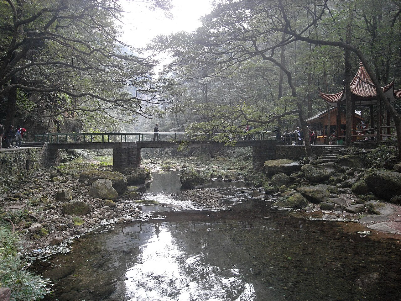
Wulingyuan combines four parts: the Zhangjiajie National Forest Park and the Tianzi Mountain, Yangjiajie, and Suoxiyu scenic zones. In September 1982 the Zhangjiajie National Forest Park became the first national forest park on the Chinese mainland. Wulingyuan was named a national scenic area in 1988, a UNESCO World Heritage site in December 1992, one of the first world geoparks in 2004, and one of the first national 5A scenic areas in 2007. Inside stand 3,103 quartz-sandstone pillars, with 88 percent forest cover and protected animals including the giant salamander and the clouded leopard. The name Wulingyuan was coined in 1984 by the painter Huang Yongyu; it had been a literary stand-in for the Peach Blossom Spring. Once through the gate, walk Golden Whip Creek, where sheer peaks line both banks of a shallow stream — the easiest walk in the park. UNESCO twice flagged Wulingyuan with yellow-card warnings over overdevelopment, in 1998 and 2013; the authorities then tore down a large number of illegal buildings and restored the vegetation, and the site passed re-inspection.
Yuanjiajie
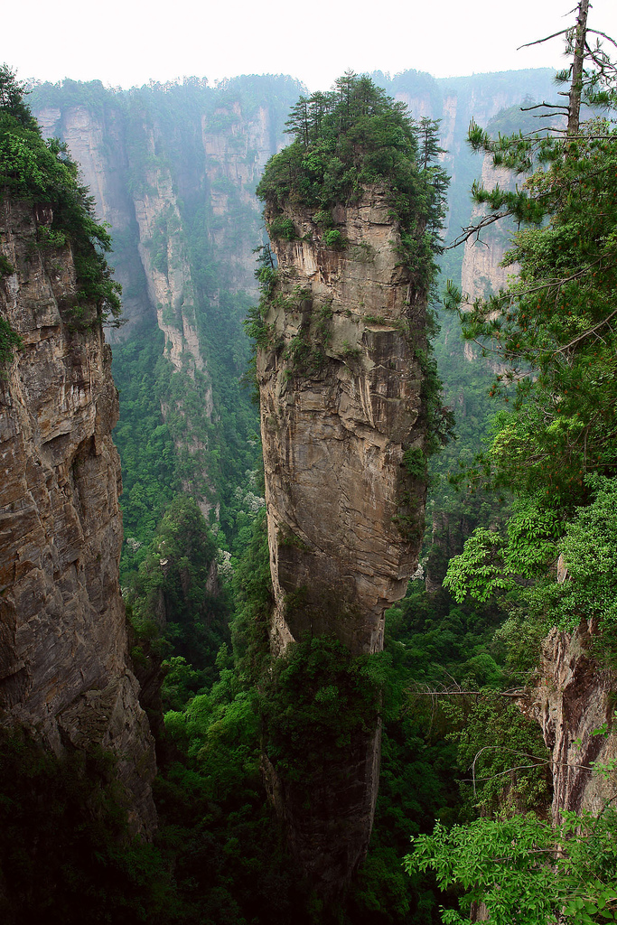
Yuanjiajie lies in the north of the forest park, covering about 1,200 hectares at a mean elevation of 1,074 meters. Its most famous pillar is the Qiankun Column, also called the Southern Sky Pillar, standing about 150 meters tall. In December 2008 the Hollywood CG designer Eric Hansen visited Wulingyuan to gather material for the film Avatar, and the Qiankun Column became the prototype for the floating Hallelujah Mountains on screen. In January 2010 the Yuanjiajie management committee renamed the spot Hallelujah Mountain, which stirred no small debate at the time. Yuanjiajie also holds the First Bridge Under Heaven, a natural stone arch between two peaks roughly two meters wide at the top — walk across it and the name explains itself. The way up is the Bailong Elevator, a sightseeing lift built against the cliff and completed in April 2002, 335 meters of vertical rise; in 2015 it was certified by Guinness as the world's tallest outdoor elevator. It queues long, so arrive early.
Tianzi Mountain
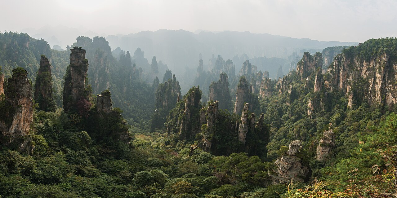
Tianzi Mountain lies in the north of Wulingyuan, covering 67 square kilometers, with its main peak, Kunlun Peak, at 1,262.5 meters. The name comes from Xiang Dakun, a Tujia leader of the late Southern Song who called himself King Xiang of Heaven; the sights around — Tianzi Islet, Sword Peak, Dragon Chair Rock — all carry his story. The circuit around the mountaintop runs more than forty kilometers, and the summit views open wide over the pillar sea — one of the best places to see it, and the clouds too. A cableway climbs the mountain, and from the top station a loop of boardwalk does the rest, taking half a day to a full day. Tianzi and Yuanjiajie sit in the same core zone, joined by scenic-area shuttles; the two together fit neatly into one day.
Tianmen Mountain
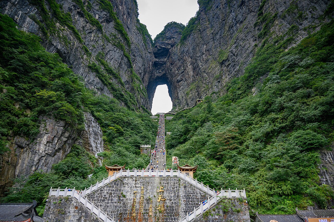
Tianmen Mountain rises in Yongding District right against the city, its main peak at 1,518.6 meters, named for the natural opening in its summit — the Tianmen Cave — and called the first sacred mountain of western Hunan. In the year 263 a great hole split open in the cliff; the local official reported it to Sun Xiu, ruler of the Wu kingdom, who took it as a good omen and named it the Gate of Heaven. The cave stands 131.5 meters high, 57 meters wide, and 60 meters deep. In July 1992 Tianmen became a national forest park, and the scenic area opened formally in September 2005. The usual way up is the Tianmen cableway, 7,455 meters long with a 1,279-meter rise — the longest of its kind in the world. Near the summit a 60-meter glass skywalk hangs over the valley. Down the other side runs the Tongtian Avenue, a 10.77-kilometer ribbon of close-packed hairpins; riding the shuttle down it is an experience on its own. From the foot of the cave climb 999 stone steps, and your legs will let you know for two days. In 1999 a stunt flying competition sent planes through the cave, and the Wingsuit Flying World Championship is held here regularly. The cableway stops in high winds — check the notices before you set out.
Zhangjiajie Grand Canyon Glass Bridge
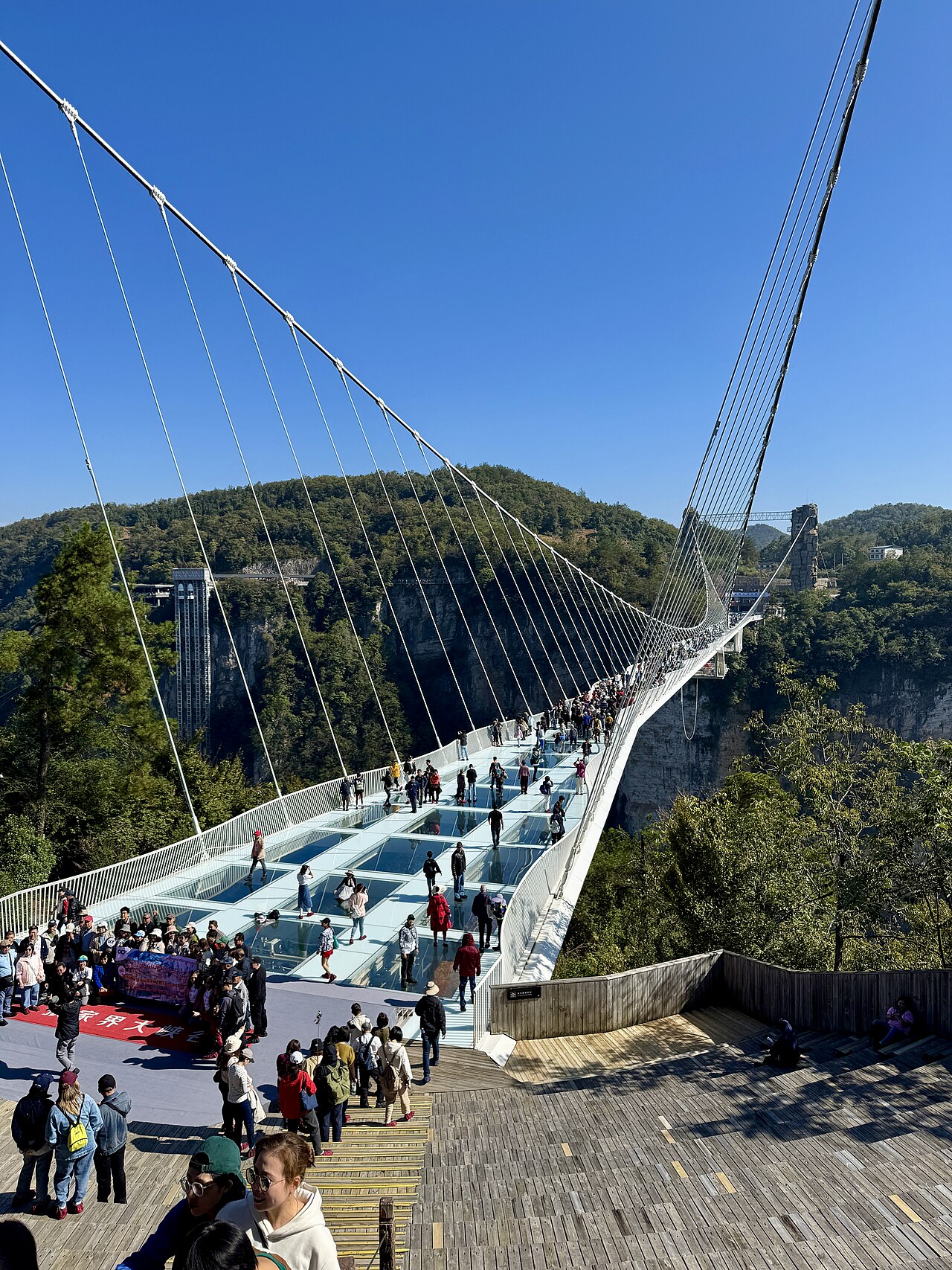
The glass bridge's official name is Yuntiandu, and it opened to visitors on August 20, 2016. It is 430 meters long and 6 meters wide, with the deck about 260 meters above the canyon floor — the longest and highest glass-bottom bridge in the world at the time it opened. It was designed by the Israeli architect Haim Dotan and won the Arthur G. Hayden Award from the International Bridge Conference in 2018. The deck is fully transparent; looking down is the canyon, and crossing takes some nerve. The bridge sits in the Zhangjiajie Grand Canyon in Cili County, about an hour's drive from either Wulingyuan or downtown. Beyond the bridge the canyon offers trail walks and waterfalls. The best angle is the viewing platform at the head of the bridge, which frames the whole span crossing between two mountains.
Huanglong Cave
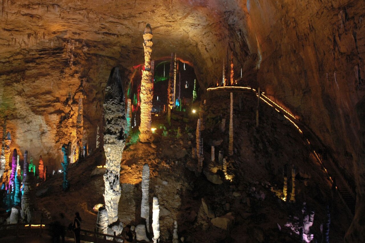
Huanglong Cave lies in Hekou Village on the Suoxiyu side of Wulingyuan, a classic karst cave and one of China's first batch of 4A scenic areas. The tour starts with a boat ride along an underground river, then continues on foot past stalagmites, curtains, and stone waterfalls — water and land in one route. The marquee sight is the Dinghai Shenzhen, the Needle That Steadies the Sea, a 19.2-meter stalagmite in the Dragon Palace hall; in 1998 the zone bought a 100-million-yuan insurance policy on it, which made the news. The cave holds a steady temperature, and summer visits are pleasantly cool. The full loop takes about two hours, with mature lighting and walkways that suit children and older visitors alike. Stalls at the exit sell kudzu root powder and other local products, at a markup over downtown prices.
Eating in Zhangjiajie
Sanxiaguo, the three-pot, is Zhangjiajie's signature dish — one pot simmering three or four items of meat and vegetables, smoked pork, pork tripe, dried tofu, served with rice and pickled radish, and it lands best on a cold day. Tujia smoked pork is cured over wood fire and shows up on every table. Rock ear, a fungus that grows on cliffs, goes into the local classic rock-ear chicken stew. Wild greens, kudzu powder, and kiwifruit are common too. Western Hunan cooking leans sour and spicy; say so early if you cannot take heat. Restaurants concentrate in downtown and the Wulingyuan town area; the ones at the scenic gates cost more, and in season the queues are long, so eat off-peak. For gifts, rock ear, smoked pork, and kudzu powder bought away from the scenic areas are better value.
How to arrange the route
Four days is comfortable; three means cutting something.
Day one, all of Tianmen Mountain. Cableway up in the morning, the glass skywalk and the Guigu plank road, the Tianmen Cave, then the shuttle down the Tongtian Avenue in the afternoon.
Day two: the Zhangjiajie National Forest Park. Walk Golden Whip Creek in the morning, cableway up Huangshizhai in the afternoon, and look over the pillar forest from the top.
Day three: Yuanjiajie plus Tianzi Mountain. Take the Bailong Elevator up to Yuanjiajie first, see the Qiankun Column and the First Bridge Under Heaven, lunch, then across to Tianzi and down by cableway.
Day four: Huanglong Cave in the morning, the glass bridge in the afternoon, and out in the evening. With only three days, drop either the cave or the bridge and keep the full day for Tianmen.
Things to confirm before you go
- The temperature gap between town and peaks is real; bring a jacket even in summer. A clear day downtown can mean fog on the mountain, and in heavy fog the pillar forest disappears — keep the plan flexible.
- The cableways, the elevator, and the glass bridge queue long, worse on holidays; buy tickets in advance through official channels where possible.
- The Tianmen cableway and the glass bridge close temporarily in high winds; check the scenic-area notices the morning you go.
- Wulingyuan sells single-day and multi-day tickets, and you must pick your entry gate; details follow official notices.
- The giant salamander is a protected species; do not buy dishes sold as baby-fish (wa wa yu).
- The glass skywalk and the glass bridge both require shoe covers, provided on site.
Frequently asked questions
How many days for Zhangjiajie?
Four days is comfortable: one for Tianmen Mountain, one for the forest park, one for Yuanjiajie and Tianzi together, and one for Huanglong Cave and the glass bridge. With three days, drop either the cave or the bridge.
How do I get to Zhangjiajie?
Zhangjiajie Hehua International Airport connects many Chinese cities directly. High-speed trains stop at Zhangjiajie West Station and the Jiaoliu railway line serves Zhangjiajie Station; schedules from Changsha and elsewhere follow 12306.
When is the best time to visit?
April to October, with September and October the most stable for weather; after rain the peaks often show a sea of clouds. Avoid the May Day and National Day holidays. For snow, come in winter for Tianmen, but expect cold and possible cableway closures.
Are the floating mountains of Avatar really in Zhangjiajie?
The floating mountains in Avatar were modeled on the Qiankun Column in Yuanjiajie, where the film's CG designer gathered material in 2008. On screen they hover; on the ground the pillar stands planted in the earth — impressive all the same.
Is the glass bridge worth it?
Yes, if you are not afraid of heights. It is much like the glass skywalk on Tianmen, so with a tight schedule, one of the two is enough.
Sources
The facts in this article were checked against the following Chinese Wikipedia entries, retrieved August 26, 2026.
- Zhangjiajie (city) https://zh.wikipedia.org/wiki/张家界市
- Wulingyuan Scenic Area https://zh.wikipedia.org/wiki/武陵源
- Tianmen Mountain https://zh.wikipedia.org/wiki/天门山
- Zhangjiajie Grand Canyon Glass Bridge https://zh.wikipedia.org/wiki/张家界大峡谷玻璃桥
- Avatar Hallelujah Mountain https://zh.wikipedia.org/wiki/阿凡达-哈利路亚山
- Bailong Elevator https://zh.wikipedia.org/wiki/百龙天梯
- Huanglong Cave (Zhangjiajie) https://zh.wikipedia.org/wiki/黄龙洞_(张家界)
The entries for Huanglong Cave and Yuanjiajie are thin; the height of the Dinghai Shenzhen stalagmite and the area and elevation of Yuanjiajie were verified through additional web research.
All photos are from Wikimedia Commons, used under CC licenses or public domain; re-use requires attribution where noted.
- zhangjiajie-jinbian.jpg from File 金鞭溪_-panoramio(1).jpg, by gdczjkk, taken November 3, 2009, CC BY 3.0
- zhangjiajie-yuanjiajie.jpg from File Wulingyuan_3.jpg, by John Philip, taken April 20, 2007, CC BY-SA 2.0
- zhangjiajie-tianzi.jpg from File 1_tianzishan_wulingyuan_zhangjiajie_2012.jpg, by chensiyuan, CC BY-SA 4.0
- zhangjiajie-tianmen.jpg from File Tianmen_38330-Zhangjiajie_(49047525877).jpg, by xiquinhosilva, taken September 1, 2019, CC BY 2.0
- zhangjiajie-glassbridge.jpg from File Zhangjiajie_Glass_Bridge_02.jpg, by Codas, taken October 25, 2024, CC BY-SA 4.0
- zhangjiajie-huanglong.jpg from File Huanglongdong.JPG, by Brookqi, taken November 2008, public domain